Want to visit SkyTEM Surveys?
Add the company to your visit request and let us know that you are interested in visiting.
Solution Provider
Company
Organisation type: Company
Groundwater management
Water management
Water resource management
Water supply
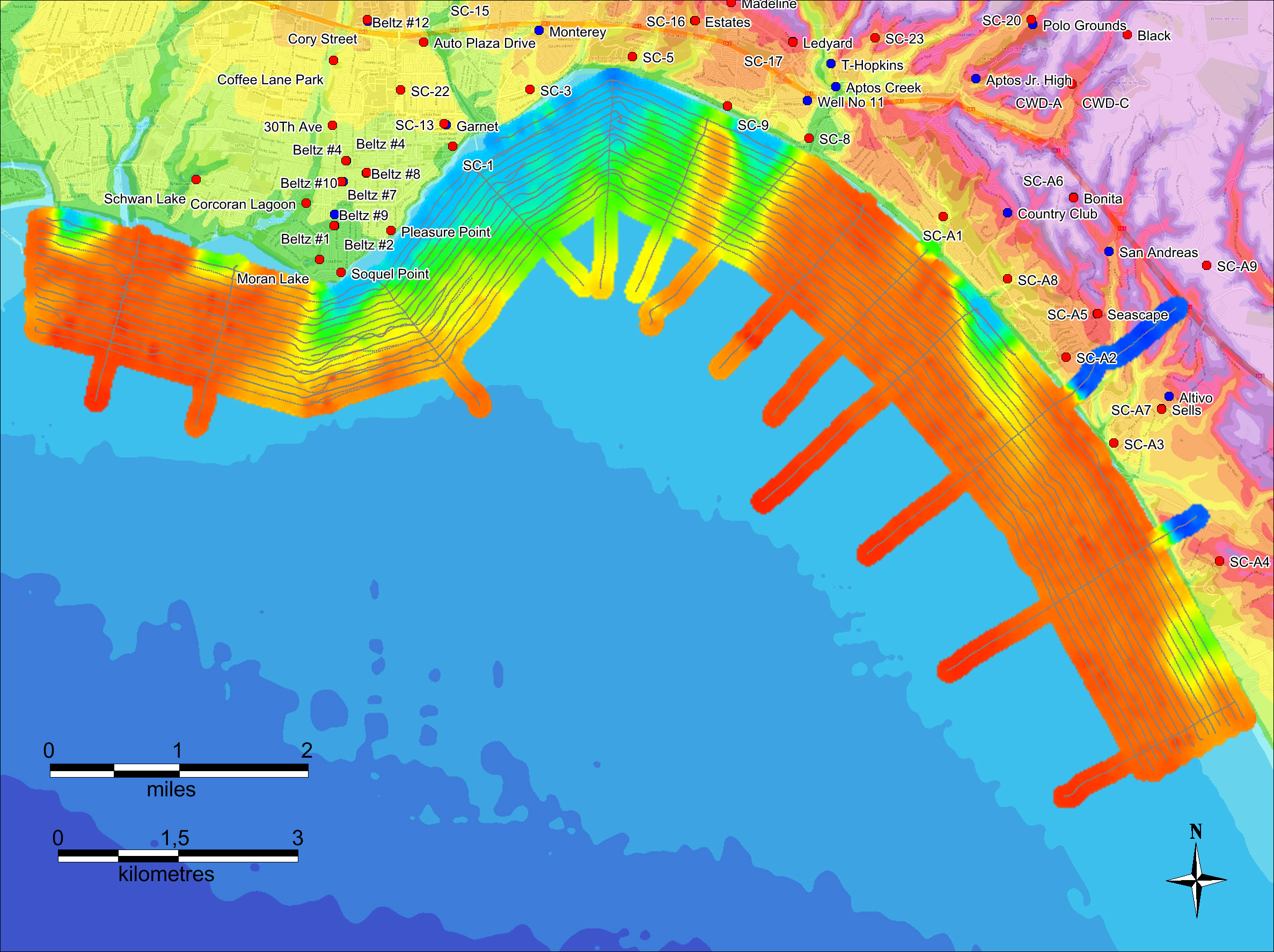
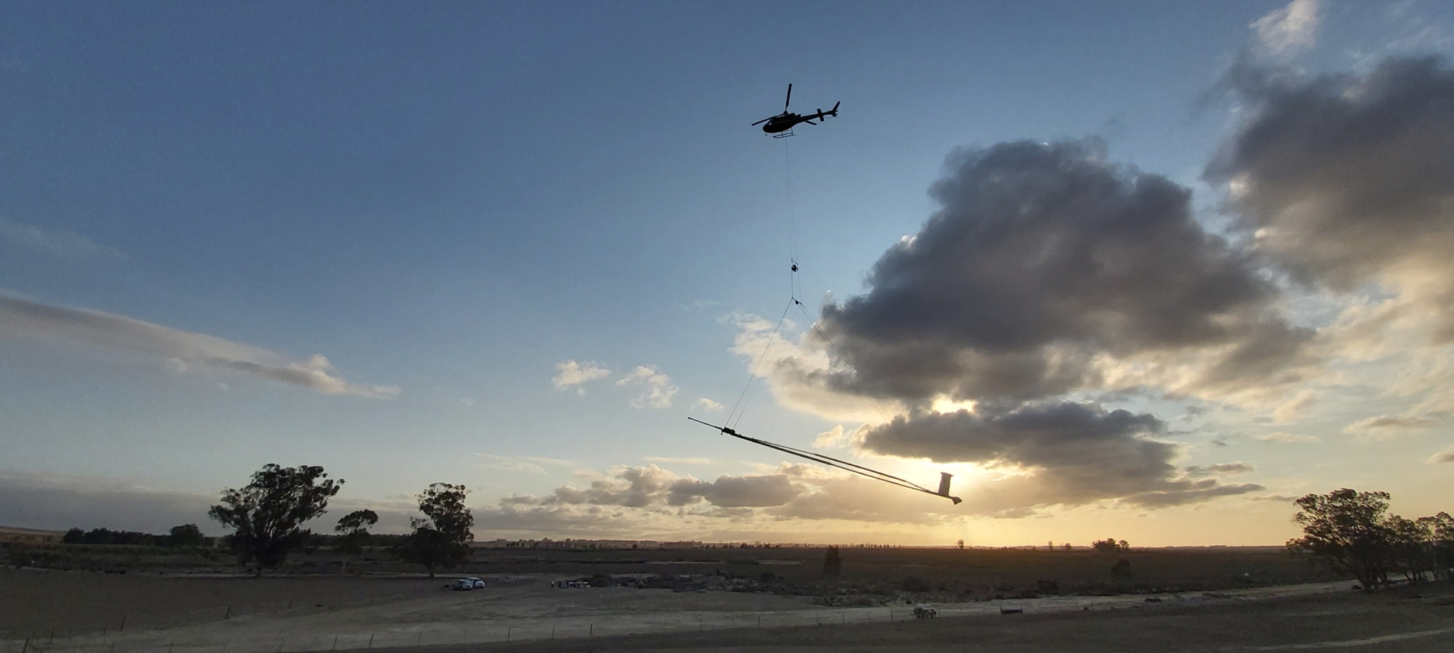
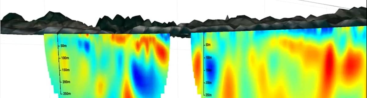
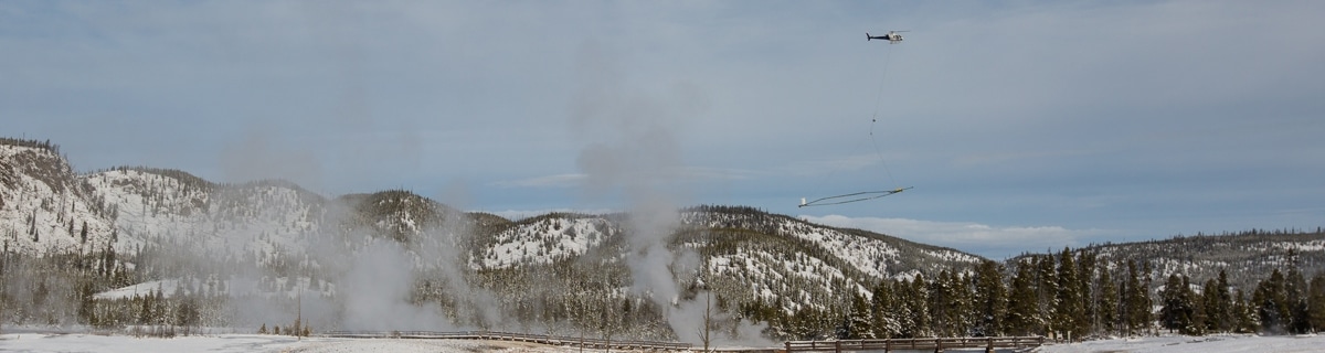
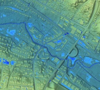
SkyTEM Surveys is a Danish airborne geophysical company with more than 12 years of experience in the mapping water resources. SkyTEM is an innovative and technologically advanced helicopter-borne geophysical system specifically designed to map buried aquifers. This unique technology, capable of mapping the top 500 metres of the Earth in fine detail in in 3 dimensions, was conceived and developed in Denmark, a country with a reputation for environmental care and R&D. SkyTEM has helped geological organizations and government water agencies on seven continents unearth a wealth of information about their aquifers and aided their understanding of how geology and mankind can affect, and be affected by, groundwater resources. Since its launch in 2003 SkyTEM has also been employed globally for resource exploration and for environmental and engineering investigations. Hydrogeology divisions of governments worldwide routinely employ SkyTEM technology to map their water resources. Clients include:
https://www.youtube.com/watch?v=qSTddN9njuk&t=27s
Add the company to your visit request and let us know that you are interested in visiting.