Solution provider

Case
Groundwater management
Water management
Water resource management
+1
Add the case to your visit request and let us know that you are interested in visiting Denmark
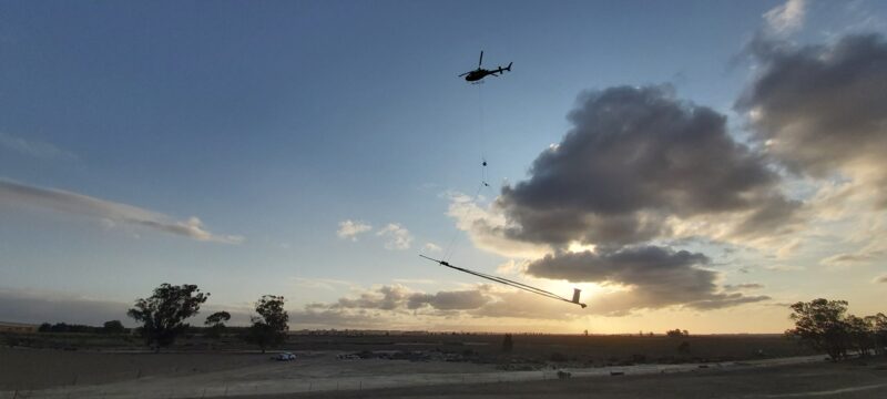
To secure a reliable water supply for the future, the local Saldanha Bay municipality, which is located north of Cape Town, has taken several strides towards incorporating groundwater into their water supply mix. The search for and use of groundwater resources has often been hindered by the fact that most of South Africa’s groundwater is stored within fractures in the bedrock, making it difficult to map and reach.
In the Saldanha Bay municipality, they are currently mixing surface water from the Berg River with groundwater from three wellfields - and have further plans for managed aquifer recharge and desalination. To sustainably manage groundwater resources in combination with existing water supply sources, while protecting the Laangebaan/Saldanha Bay area ecosystem, the municipality is aware that germane data is the basis for all decisions. To obtain knowledge about the geology and groundwater resources in finer detail, they engaged groundwater mapping experts to survey and provide 3D mapping of a 2400 km2 large area. SkyTEM Africa performed the data collection, employing its proprietary airborne electromagnetic geophysical method. Data were analysed and modelled to locate groundwater resources and inform the management of these resources in a sustainable manner.
Contributors: Saldanha Bay Municipality, SkyTEM, Institute for Water Studies - University of the Western Cape