Solution provider

A top-100 research university with excellence across all major disciplines. We are committed to turn frontier research into innovative solutions.
Case
Groundwater management
Water management
Water resource management
A top-100 research university with excellence across all major disciplines. We are committed to turn frontier research into innovative solutions.
Add the case to your visit request and let us know that you are interested in visiting Denmark
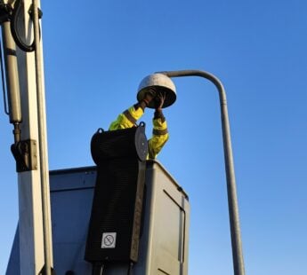
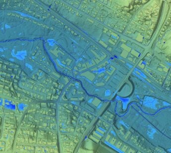
World-wide the groundwater resources are becoming increasingly important as a source for drinking water supply and irrigation of farm fields. The airborne SkyTEM system developed at Aarhus University has been a key player for mapping the groundwater beneath the soils in Denmark. Now, a team of researchers from Aarhus University is on its way to India to work on groundwater mapping with Indian collaboration partners and the World Bank.
In India a large proportion of the population lives in coastal areas, which challenges the groundwater resources. If too much groundwater is extracted in areas close to the coast, salt water from the sea will penetrate and ruin the groundwater reservoirs.
Once the project has mapped the groundwater reservoirs in India, the population and the authorities will have the necessary information to help manage the water resources without destroying them in the long term.
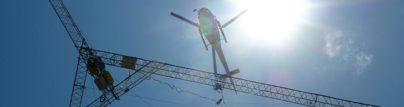
The SkyTEM system is an advanced solution for mapping groundwater below the surface. The technology makes it possible to use an antenna suspended below a helicopter to scan the uppermost layers of the earth to a depth of 200 to 300 metres. The researchers can then view underground groundwater landscapes as 3D images.
Read more about SkyTEM here and take a look at their State of Green profile here.