News
Water resource management
Water supply
Mapping Water in Yellowstone National Park


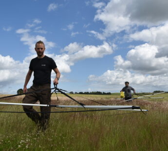
The United States Geological Survey (USGS), University of Wyoming and Aarhus University in Denmark are applying the SkyTEM method to collect data over portions of Yellowstone National Park. The objectives of the airborne survey are to map lithological variations and structural controls on groundwater flow within the Park to delineate zones of cold fresh water, hot saline water, steam, clay and unaltered rock to gain a better understanding of Yellowstone’s myriad hydrothermal systems.
The high quality data collected by the SkyTEM312 time-domain electromagnetic system data are intended for rigorous inversion and interpretation of the 3-D hydrogeologic conditions of the subsurface and will provide the first subsurface view of Yellowstone’s hydrothermal systems, tracking the geophysical signatures of geysers, hot springs, mud pots, steam vents and hydrothermal explosion craters to depths in excess of 1,000 feet.
The engineering built into SkyTEM technology is centered on the ability to deliver airborne data comparable to data collected by calibrated ground geophysical instruments. SkyTEM has carried out several surveys for the USGS in California, Montana, Nebraska, Colorado, Washington and Alaska. Over the last decade SkyTEM has completed many groundwater projects for governments, scientific organizations and private industry world-wide.
Read more about airborne geophysics.
More photos and video available from News Media.
Geophysical survey to uncover Yellowstone’s subsurface mysteries
The USGS has published a press release on the new study investigating groundwater from the air. Follow the link.
Much more media about the project:
Wyoming Public Media: Scientists Use Electromagnetic Technology To Examine What Lies Beneath Yellowstone
Winona Daily News: Researchers seek to find Old Faithful’s underground plumbing
You should consider reading
solutions
Climate change adaptation
+4


