Solution provider

Ramboll is a leading international architecture, engineering, and consultancy company, owned by the Ramboll Foundation.
Case
Groundwater management
Water management
Water resource management
+1
Ramboll is a leading international architecture, engineering, and consultancy company, owned by the Ramboll Foundation.
Add the case to your visit request and let us know that you are interested in visiting Denmark
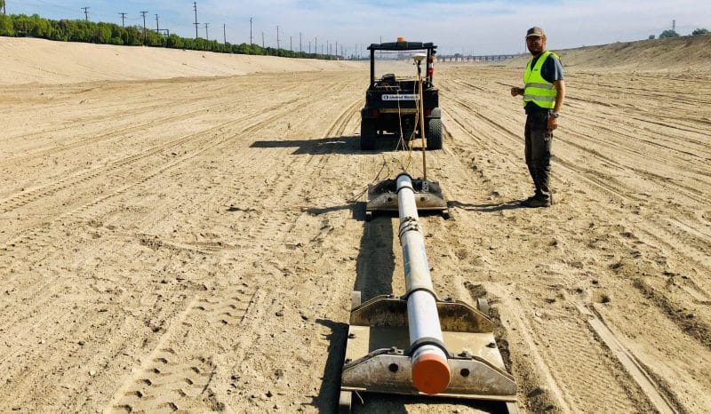
This includes infiltration of multiple water sources, including surface water from the Santa Ana River. Water from the Santa Ana River is diverted to multiple recharge facilities, including off-river channels for infiltration. To maintain and optimise infiltration in the off-river location, the upper sediment layer is continuously removed, at a cost.
Over time, OCWD has conducted a number of investigations to obtain further knowledge of the topsoil conditions. These have primarily consisted of costly borehole and labour-intensive excavation investigations, providing only partial understanding. To be able to interpolate the spatial distribution of the shallow sediments, OCWD had an off-river infiltration basin mapped. The mapping was performed by an electromagnetic geophysical survey, which offers detailed mapping of the soil’s electrical resistivity in the top eight meters. Together with the previously obtained borehole information, the result from the geophysical survey provided detailed and elaborated insight into what areas of the off-river channel the majority of water infiltrates and how water nfiltration rates can be enhanced by trenching.
Contributors: Rambøll, Orange County Water District (OCWD)