Methodology for fast and reliable Investigation and Characterization of Contaminated Sites (MICCS)
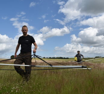
MICCS is a new high-tech method for mapping underground pollution. The method was developed through a partnership of five European companies and funded through the EU's 7th Framework. MICCS leverages a number of new, cutting-edge technologies in order to produce a survey tool that provides a very high data density and security, while being both fast and economical. The method uses a patented geo-radar for initial screening and a sonic probe with a built-in unique triple sensor that can detect specific contaminants even in very low concentrations.
During the development process, MICCS has been used in locations with different types of contaminants, both in the Netherlands and Denmark, and has shown compliance with traditional survey methods. During the summer of 2014, additional studies were carried out to produce systematic documentation of the method. These studies have been carried out in cooperation with authorities of Danish and northern German regions.


